Paddling the rivers in March:
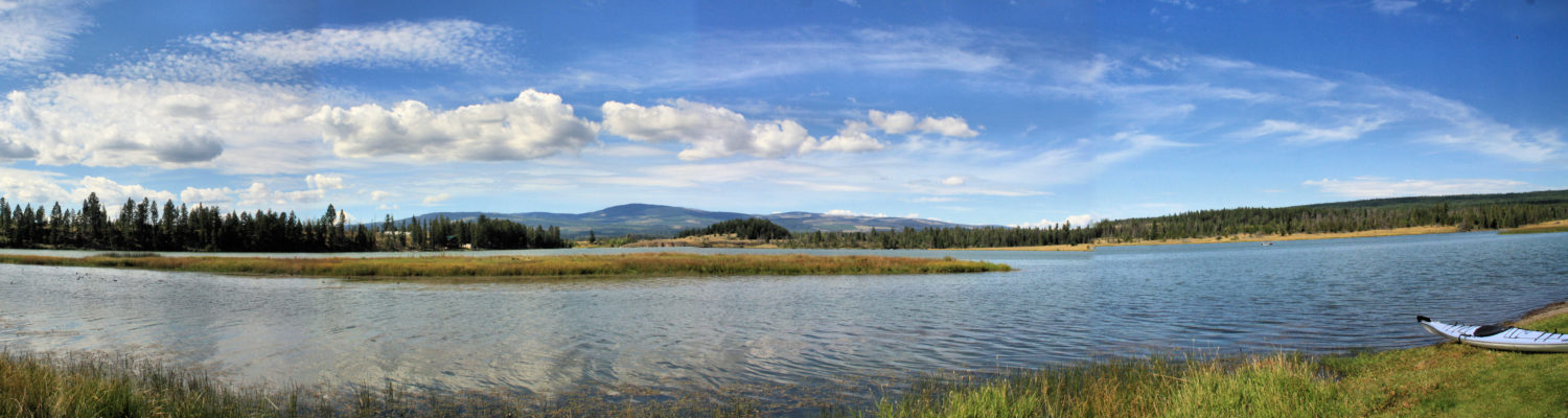
To the lakes now…
Paddling the rivers in March:
To the lakes now…
The first few days of paddling each year are spent on the river, launching from Pioneer Park, Riverside Park, or Valleyview. Once the weather warms and the winds abate, the valley-bottom lakes are next. On a calm March morning the winds were light and the sun was out on the South Thompson River.

There were ducks and geese on the river. On the shore were crows, magpies, and an occasional dog walker. A swan flew overhead, heading upstream. I paddled up past the Yellowhead Highway Bridge and turned around, happy with a one hour paddle on the river.

In mid-March the weather was perfect for an early paddle on the rivers. From Pioneer Park, the route was downstream, under the Red Bridge, then under the Train Bridge toward the Confluence of the South Thompson and the North Thompson Rivers.

There are a number of sand and gravel bars at the Confluence so it is best to stick to the south shore, passing under a third bridge (Overlander Bridge) and beyond down the Thompson River to the old bridge pylons from the old (1925 to 1961) Black Bridge.
 Beyond the pylons, we can still see the footings of the older-yet White Bridge (1901-1925). At low water, these are rocky high spots in the river. Paddling around these, I returned back upstream, paddling toward the morning sun.
 There is a bit of turbulent water at the Confluence. Progress upstream is slow.
 Paddling down toward Rabbit Island and back is about 6 km. This is a better paddle in the early or late season when there are no powerboats on the river. Paddling on a day without strong winds is always a good practice.
Here is a good article on the bridges – The Bridges of Kamloops
The first days of kayaking each year are done in cool weather and the water temperature is cold, dangerously cold if you capsize. When I go out, I take the following precautions.

I was paddling on Paul Lake at the first ice off and there was a family with a Costco kayak there, taking turns. No PFDs and paddling out to the middle of the lake… I told the parents that if someone tips, that person would not survive and anyone on the shoreline would not be able to rescue them. I was given a cold glare and no response.
Near the start of October I returned back to the river. When time is short, I can launch the boat at Pioneer Park and paddle up the river and back in an hour. On this day, I paddled the river, then secured the boat and played tennis right next-door.

Some fall color is a feature of fall paddling on the South Thompson River. Winds were light and there were no other boats on the river.
 A few ducks dabbled in the river. There were lots of birds – an eagle, magpies, crows, gulls, robins, woodpeckers, and various smaller species.
 The river is too busy and too noisy in the summer so we wait until October to return. There will be more days of paddling on the river before the end of the kayaking season.
 And a short Youtube video of this paddle:
The boat launch on McArthur Island had a land-locked muddy pond, then there was a portage out to the river channel. This access proved to be muddy and a bit difficult. Once in the shallow channel, I paddled upstream in fast water, over gravel bars and eventually into the main river. Conditions improved a few hundred meters upstream.
 The route was up toward Overlander Bridge, then down the other side of the river around Rabbit Island down to Mission Flats beach, across the river, and then up the channel between McArthur Island and Rabbit Island against the current in faster water.
 Moments from the Thompson River Romp are captured in this YouTube video:
To be honest, this wasn’t a great paddle. The shallow channels were difficult, access to both ends of the lagoon was gone, the skies were smoky, and there was lots of noise from airplanes, trucks, and trains. Another day of paddling added though, Day 55 this year.
By June 1st the river was already dropping a bit, but we can still access the floodlands for a couple of weeks yet.
 On this day I paddled west down to Cooney Bay. There is no beach at high water and the shoreline is packed with floating logs. The high water extends up the Tranquille River outlet for 150 meters.
 After kayaking through Cooney Bay, I paddled upstream through the floodlands
 The bays were calm, except for the activity of waterfowl.
 It is wonderful to paddle in the floodlands each spring during freshet.
We can usually expect to paddle in the floodlands area near Tranquille by the end of May. High water lasts for 2 – 6 weeks, but usually it has receded by the end of June. On May 12, I was able to launch my kayak into the floodlands using a hand launch in the Tranquille Wildlife Management parking area. There was enough water to paddle over the tops of barbed wire fences. Many of the channels were full of debris, but there were also open water channels out to the river.

Later in the season we can paddle across the river and go up more floodlands channels on the south side of the river. A 10 km loop through the floodlands is possible during freshet.
 A few moments of the morning of paddling are found in this YouTube video:
In the early days of April, mornings are still cool (-2 to +2) and winds start late morning so the best time to paddle is mid-morning. It was all quiet at the Valleyview Boat Launch, but the river was very low, so the 18 foot kayak had to be hefted down to the rocky shoreline.

A light breeze from the west meant bundling up. A full dry suit and a spray skirt make the paddling comfortable.

There were lots of birds on and around the river – an eagle, swans, geese, ducks, crows, magpies, and seagulls were active below the noisy city. It was a paddle upriver-and-back day, building fitness for the season ahead. The next paddle should be on one of the larger lakes in the valley bottom, but with cool days it will have to be a day with little wind.
In early March we can paddle the rivers or the large lakes in the bottom of the valley. On a sunny morning I paddled downstream from Pioneer Park, under the Red Bridge, under the Train Bridge, through the Confluence of the two rivers, under the Overlander Bridge, and under/around the old Black Bridge before turning around close to Rabbit Island.

On the way back up the Thompson River to the Confluence and past Riverside Park, then upstream on the South Thompson River, the same 3.5 bridges were passed. No one else was on the water, but there were geese, ducks, crows, magpies, and seagulls on the river or the rivershore.
 A YouTube video captures some of the paddling moments:
It should be noted that I wear a full dry suit and have all the safety gear and for anyone to go on the river without adequate preparation for cold water risks is not advised.
The first day of kayaking for 2022 was March 2. In 2023, colder weather kept ice on the river and when it started to break up cold winds prohibited comfortable paddling. By March 12, we had signs of spring coming and on March 14 the winds were about 10 km out of the east. Boat launch gates were still locked so getting to the water was more challenging, but can be done at a couple of spots. In this case, there is a new concrete boat launch ramp at Pioneer Park so that was the location for the first paddle of the year.
The launch was easy, wearing a dry suit and neoprene boots for cold-water protection. The paddle upstream was slower with a headwind and a current.

The first few paddles will all be on the river – upstream, downstream, and at other launch spots. All efforts will de dependent on the winds each day.

A short video features some of the moments on the river:
The ice is clear of the river for enough to go out for some early season paddling, but we have to ask ourselves, “Should we?”
 The considerations are keeping warm and staying safe.
 Keeping Warm:
Staying Safe:
I have seen paddlers out in open cockpit kayaks with no evidence of safety equipment. I always want to ask them – “What’s your plan if you flip?”
Even if you have a dry suit, a PFD, neoprene boots, a paddle float and you know how to do self-rescue, you are still at risk for surviving a cold-water immersion. It might be best to wait for warmer conditions.
As the snows melt in the mountains, freshet will swell the South Thompson and North Thompson Rivers and the Thompson River will flood the lands near Kamloops Lake. From the start of June through the first week of July we can launch our boats near Tranquille and paddle various routes through the bays and channels.
 In early stages, grasses and logs rise above the water.
 As the floodwaters rise, there are more routes to paddle between the Airport and Cooney Bay.
 On days with little wind, reflections onto the floodwaters give the area a dreamy effect.
 Longer routes can be paddled of up to 11 km, but most days we paddle between 5 and 8 km, choosing an eclectic route through the channels:
Relive ‘Paddling the Floodlands’
At the height of freshet, all of the channels on both sides of the Thompson river fill with water. We can paddle across Tranquille Bay to the far side of the river, and then follow channels upstream and back out to the river.
 On a calm day we can enjoy the reflections in the bays and channels.
 Navigating the maze of channels takes a while to learn, but its fun to try different routes.
  A few video clips show the views on this 10 km loop route.
More Information:
As the last days of paddling in 2022 approached, I found a calm morning on the river paddling from Pioneer Park. A paddling jacket, gloves, and a sprayskirt made this outing fine (for now).

At this time of year I have the river to myself, except for a few ducks, geese, and other birds.
On a fall day, the river was calm, the sun was shining, and the downriver flow had slowed down to allow easy paddling.
 I paddled downriver to the highway bridge area and back up, another section of the South Thompson River worth kayaking


